Roth, M.; Hildebrandt, S.; Roser, F.; Schwarz-von Raumer, H.-G.; Borsdorff, M.; Peters, W.; Weingarten, E.; Thylmann, M; Bruns, E.: Entwicklung eines Bewertungsmodells zum Landschaftsbild beim Stromnetzausbau. Bonn-Bad Godesberg, 2021.
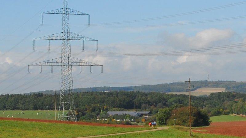
The three factors of diversity, individuality and beauty as well as the recreational value of the landscape, as specified in the Federal Nature Conservation Act (BNatSchG), are modelled and evaluated separately. Using geographic information systems (GIS) and statistical analyses, nationwide assessment models are developed, which are calibrated and validated on the basis of user-assessed landscape photos. The assessed landscape photos were taken as part of a photo documentation in 30 representative sample areas, each about 150 km² in size, within Germany. This sample represents the diversity of German landscapes, from coastal regions to the Alps, from forested areas to rural areas and urban agglomerations. An expert-based selection of more than 800 landscape photos was evaluated in an online survey in cooperation with a social science panel of more than 3,500 participants. The participants rated a random selection of the photos with regard to the experience dimensions of diversity, uniqueness, beauty and recreational value on a nine-point scale.
The landscape elements, land uses and landscape structures visible in the assessed landscape photos were analysed with the help of a geoinformation system. For this purpose, the project identified more than 80 landscape assessment indicators mentioned in the literature, which can be operationalised in GIS using nationally available and homogeneous data (e.g. occurrence of land use types, relief, structural diversity). The occurrence of the individual indicators in the landscape section visible in the photos was determined. On the basis of linear regression, evaluation models were calculated that describe the relationship between the object side of the landscape in the form of the determined occurrence of the different landscape features and the subjective landscape evaluations. One such assessment model was calculated for each of the different experience dimensions: diversity, uniqueness, beauty and recreational value. The model for recreational value is based on data on tourism supply and demand in addition to the analysed survey and landscape structure data.
The four models each explain 61 to 65 % of the variance of the perceived expression of the respective experience dimension. In addition, an overall significance was calculated from diversity, distinctiveness and beauty, which is decisive for a practical nationwide assessment of the landscape. Each model is applied nationwide. The results are presented in maps that show a nationwide landscape assessment in nine levels. The resolution of the assessment results is determined by square assessment grids of 1 km x 1 km.
Based on the landscape assessment models, which are used to derive the importance of an area for the landscape and the recreational value, a method was developed for assessing the conflict risks of landscape and recreational value in relation to the new construction and expansion of overhead lines and underground cables. For this purpose, the respective landscape and recreational value-related significance of the area was aggregated with the sensitivity of the area to the specific effects of the project types. Finally, the methods for the assessment of the conflict risks of landscape and recreational value with regard to overhead lines and underground cables were applied in an exemplary test area.