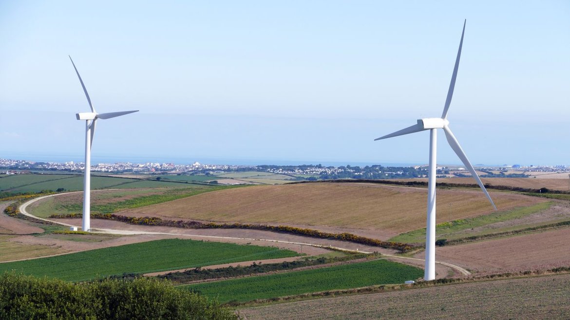
To what extent is the network of Natura 2000 protected sites affected by the expansion of renewable energies? The project will examine this question by selecting methods and remote sensing data and looking at changes in grassland in Natura 2000 sites as well as in typical arable farming areas.
The studies was carried out using time series of suitable remote sensing data, focussing in particular on analysing and quantifying the change in the proportion of grassland in Natura 2000 sites (ploughing, reseeding, conversion to arable). In addition – and to the extent possible from the current state of scientific knowledge – qualitative statements were derived on the change to grassland.
Further analyses were carried out relating to changes in typical arable farming areas, e.g. considering the proportion of maize in areas occupied by the common hamster and bird roosting areas (e.g. dotterel). The peripheral areas of selected Natura 2000 sites were also included in the data analyses in order to be able to assess increasing isolation or fragmentation effects.
In the first step, suitable remote sensing data and geodata were collected, selected and evaluated and used to assess the land cover and changes in a time series analysis. Remote sensing methods were tested and applied to sample areas. The results were used to quantify the proportions of grassland and arable and their changes through e.g. conversion to arable in the Natura 2000 sites, the reference sites and the surroundings of the Natura 2000 sites, and to analyse these habitat changes for the target species of common hamster and dotterel.
The occurrence of and changes in grassland areas (= agricultural grassland and other grassland) in Germany were evaluated over the reference periods 1990 (1989-1991), 2006 (2005-2007) and 2016 using multi-temporal time series from Landsat 4/5 and Sentinel-2 data. Good to very good results were achieved. An overall accuracy of over 90 % was achieved for the 2016 period. The high quality of this product was compared and confirmed with the European High Re-solution Layer Grassland of the EEA from the same period.
The historical time periods 1990 and 2006 did not show sufficient qualities to derive a statistically valid trend analysis 1990-2006. Deviating from statistical time series of the Federal Environment Agency (UBA 2018) and federal statistics (DeStatis 2019), a grassland increase from 2006-2016 was detected in the investigated period, which could be due to the insufficient classification accuracy as well as the different sensor technology and data availability.
The results from 2016 were used to create nationwide area statistics and compared with the available data from LUCAS. A very high matching level was found, showing that by combining the precise field information from LUCAS and the use of Sentinel-2 time series, a grassland monitoring procedure can be implemented operationally and with high quality in Germany.
Finally, the classification methods were used to detect land cover changes within the field hamster occurrence areas and the preferred resting areas of the Mornell's plover in Germany in the period 2006-2016. An area estimate of the main agricultural cropping groups was carried out, which showed that there was:
Finally, the results of the FE-based grassland classification were compared with existing terrestrial grassland habitat type mapping. Within three test regions, the dominant grassland habitat types could be identified very satisfactorily via remote sensing. With repeated use of remote sensing, terrestrial grassland area losses could thus be detected. Problems arose in the case of very structurally rich terrestrial grassland habitats which are often composed of several land cover classes (e.g. grassland, hedges, trees, small water bodies).
The results of the project were published in the BfN publication series.
EFTAS Fernerkundung Technologietransfer GmbH
Oststr. 2-18, 48145 Münster
Oliver Buck
Tel.: +49 251 13307-0
Oliver.Buck(at)eftas.com
GAF AG
Arnulfstr. 199
80634 Munich
Regine Richter
Federal Agency for Nature Conservation (BfN)
Konstantinstr. 110, 53179 Bonn
II 2.2 EU Habitats Directive, Natura 2000
Götz Ellwanger
03.04.2024
Weiter

03.04.2024
Weiter
15.02.2023
Weiter

How can the expansion in renewable energies be designed in harmony with nature? The Federal Agency for Nature Conservation (BfN) is providing expert scientific advice on this question to the Federal Ministry of the Environment, Nature Conservation and Nuclear Safety (Bundesumweltministerium, BMUB). Research by the BfN always has a practical application and generates scientific results for advising government i.e. supplies a basis for decision-making for the preparation, implementation, monitoring and further development of nature conservation measures and the Federal Government's nature conservation policy.